
Rain, Clouds and City Limits!
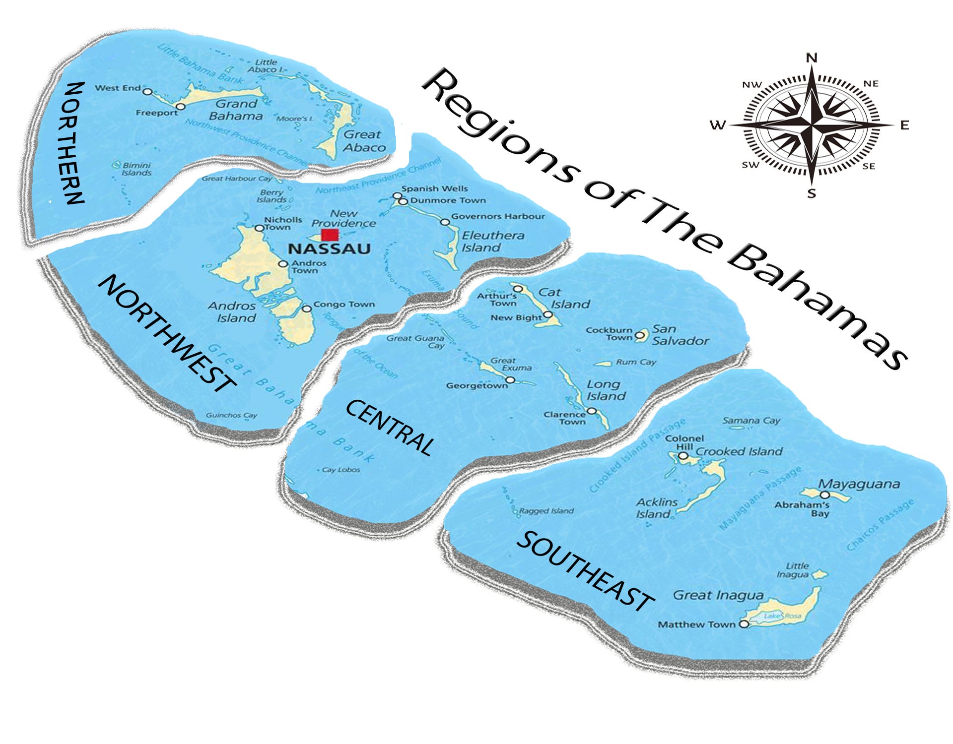
This week's forecast for The Bahamas for August 31 - September 6.

This newsletter is brought to you by Marjahn Finlayson.
Cold weather moving down bringing some snowy energy (as in precipitation)!

Birthday Shoutouts
Happy birthday to Carllisa Saunders, Danielle Gibson, Jhanée Finlayson, Kelli Armstrong, Joanna Paul, Cyerra Gibson, and Barrise Griffin!

Do you want a birthday shoutout? Click here to fill out a quick form.
Special Sky Report!
The first quarter moon occurred very early this morning at 2:25 a.m. This week, the sun will set between 7:22 and 7:28 p.m. and rise between 6:49 and 6:52 a.m. Saturn, Venus, Jupiter, Mars, and Uranus will be visible in the sky, while Mercury and Neptune will be difficult to see.
Next week, the full corn moon will occur on Sunday at 2:10 p.m. There will also be a lunar eclipse at occurs on the same day, but it will not be visible in The Bahamas.
See what astronomers are saying here and what's visible in the Bahamas here.

Virgo Season carries on with the first quarter moon in Sagittarius, which is honing in on big reality checks to steer you on your individual path especially when it comes to work, chores and health. Mercury will remain in Leo until Tuesday when it will move into Virgo, which means our thinking will go from grand ideals to be more precise and conservative in our thought process. Be careful not to miss the whole picture when looking at all details. Venus is Leo means love is grand and wonderful and a good time to try new financial ventures. Mars in Libra has a hard time with strategy but we can be warriors for justice and peace.
What do the astrology people say about ALL this?
Let's get into this week's forecast!
Current Conditions:
The radar and satellite show rain activity mostly over the northern and northwest regions due to a possible trough over these regions.
Tonight
Expect rainy conditions with clouds everywhere except in the southeast where there will likely be cloudy conditions. Thunderstorms are likely in all regions where it rains. Mostly westerly and southwesterly winds will be light (5 - 10 kts) in the northern and northwest regions. Weak (0 - 5 kts) and light winds will have varying directions in the central region. Southeasterly and easterly winds will be weak and light in the southeast. Temperature lows will be near 79 - 81°F in the northern region, 76 - 79°F in the northwest, 80 - 81°F in the central region, and 81 - 82°F in the southeast.
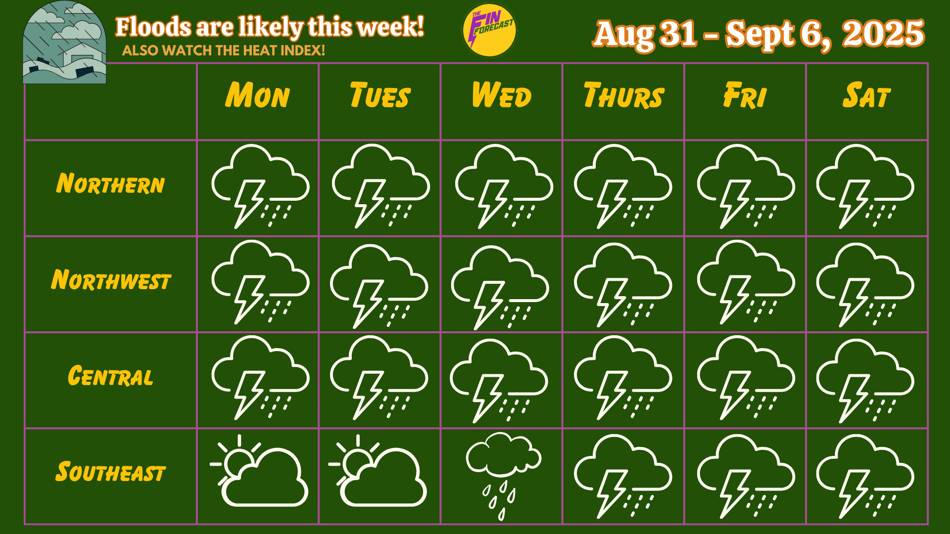
The Week Ahead:
Quick Summary:
SALT LAKE CITY RAIN! Not really, but it is about to be a RAINY week! Rain accumulation may range between 2.00 - 3.50 inches by next Sunday in the northern region. In the northwest, they may range between 0.50 - 5.00 inches. In the central region, they may range between 0.30 - 4.00 inches and 0.10 - 0.75 inches in the southeast. Flash flooding and flooding is likely in low-lying areas! This is also a reminder that you can see total rain accumulation here for multiple islands, thanks to the CoCoRAHS network!
The heat index will also be high this week so get ready to feel the heat! To get an idea of how hot it may feel, add the heat index number to the high and low temperatures in these forecasts. Please watch out for Heat Advisories from the Bahamas Department of Meteorology!
The Blog:
On Monday, expect rainy and cloudy conditions everywhere. Rainfall will be moderate to heavy in the northern and northwest regions, moderate in the central region, and light in the southeast. Thunderstorms are likely to occur everywhere, except in the southeast where they are possible. Mostly southwesterly winds will be weak and light in the northern region. Southwesterly winds will be weak and light in the northwest. Southerly and southwesterly winds will be weak and light in the central region. Southeasterly and easterly winds will be light in the southeast. Temperatures will range with highs near 85 - 86°F and lows near 79 - 80°F in the northern region (Heat index +8°F to +10°F), highs near 88 - 90°F and lows near 76 - 79°F in the northwest (Heat index +10°F to +11°F), highs near 86 - 87°F and lows near 80 - 81°F in the central region (Heat index +10°F to +11°F), and highs between 89 - 91°F and lows near 81 - 82°F in the southeast (Heat index +13°F to +14°F).
On Tuesday, expect rainy and cloudy conditions everywhere, especially in the northern, northwest and central regions. Rainfall will be moderate to heavy in the northern region, heavy to very heavy in the northwest, moderate in the central region, and light in the southeast. Thunderstorms are likely to occur in the northern, northwest and central regions, and possible in the southeast. Mostly southerly and southwesterly winds will be weak and light in the northern region. Southwesterly winds will be light in the northwest. Southerly and southeasterly winds will be light and weak and become more westerly later in the evening. Southeasterly and easterly winds will be light and calm (10 - 15 kts) in the southeast. Temperatures will range with highs near 86 - 87°F and lows near 79 - 80°F in the northern region (Heat index +9°F to +11°F), highs near 88 - 90°F and lows near 76 - 79°F in the northwest (Heat index +11°F to +12°F), highs near 87 - 89°F and lows near 80°F in the central region (Heat index +10°F to +12°F), and highs between 88 - 94°F and lows near 81 - 82°F in the southeast (Heat index +13°F to +15°F).
On Wednesday, expect rainy and cloudy conditions everywhere, especially in the northern, northwest and central regions. Rainfall will be moderate to heavy in the northern and northwest regions, moderate in the central region, and light to moderate in the southeast. Thunderstorms are likely to occur in the northern, northwest and central regions, and possible in the southeast. Southwesterly winds will be weak and light in the northern region, and light and calm in the northwest. Southerly winds will be weak and light in the central region. Southeasterly winds will be calm and light in the southeast and may weaken later in the evening. Temperatures will range with highs near 86°F and lows near 79 - 80°F in the northern region (Heat index +9°F to +10°F), highs near 87 - 89°F and lows near 77 - 80°F in the northwest (Heat index +11°F to +12°F), highs near 86 - 87°F and lows near 80 - 81°F in the central region (Heat index +11°F to +12°F), and highs between 87 - 92°F and lows near 81 - 82°F in the southeast (Heat index +12°F to +14°F).

On Thursday, expect rainy and cloudy conditions everywhere, especially in the northern and northwest regions. Rainfall will be heavy in the northern and northwest regions, moderate to heavy in the central region, and light to moderate in the southeast. Thunderstorms are very likely to occur in the northern, and likely northwest, central and southeast regions. Southerly and southwesterly winds will be light and calm in the northern and northwest regions. Southerly and southeasterly winds will be light and calm in the central region, but may weaken and become more westerly in the evening. Southeasterly winds will be light and calm in the southeast. Temperatures will range with highs near 85 - 86°F and lows near 80°F in the northern region (Heat index +9°F to +10°F), highs near 88 - 90°F and lows near 77 - 80°F in the northwest (Heat index +11°F to +12°F), highs near 87°F and lows near 81°F in the central region (Heat index +11°F to +13°F), and highs between 88 - 90°F and lows near 81 - 82°F in the southeast (Heat index +13°F to +15°F).
On Friday, expect rainy and cloudy conditions everywhere, especially in the northern and northwest regions. Rainfall will be very heavy in the northern region, heavy in the northwest, moderate to heavy in the central region, and light to moderate in the southeast. Thunderstorms are very likely to occur in the northern region, likely in the northwest and possible in the central and southeast regions. Southwesterly winds will be light and possibly may become more easterly and stronger later in the day in the northern region. Light and calm southerly winds will become weak and light mostly easterly winds in the northwest. Southeasterly winds will be light and calm and may become weaker and more variable in the central region. Southeasterly and easterly winds will be light and calm in the southeast and may become weaker later in the day. Temperatures will range with highs near 86°F and lows near 79 - 81°F in the northern region (Heat index +9°F to +10°F), highs near 86 - 90°F and lows near 77 - 80°F in the northwest (Heat index +10°F to +12°F), highs near 87°F and lows near 80 - 81°F in the central region (Heat index +11°F to +12°F), and highs between 87 - 89°F and lows near 81°F in the southeast (Heat index +13°F).
On Saturday, expect rainy and cloudy conditions everywhere, especially in the northern region. Rainfall will be heavy to very heavy in the northern region, heavy in the northwest, and light to moderate in the central and southeast regions. Thunderstorms are very likely to occur in the northern region, likely in the northern region and possible in the central and southeast regions. Light and calm southerly and southeasterly winds will become light easterly winds in the northern region. Southeasterly and easterly winds will be light and calm in the northwest and central region, and calm in the southeast. Temperatures will range with highs near 85 - 86°F and lows near 79 - 81°F in the northern region (Heat index +9°F to +10°F), highs near 87 - 89°F and lows near 77 - 80°F in the northwest (Heat index +10°F to +12°F), highs near 87°F and lows near 80°F in the central region (Heat index +10°F to +11°F), and highs between 87 - 89°F and lows near 81°F in the southeast (Heat index +12°F to +14°F).

Hurricane News
There is one system in the Atlantic right now (yellow). It has a 0% chance of formation in the next 48 hours and a 30% chance in 7 days.
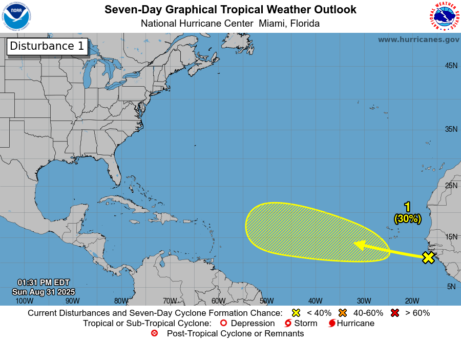
The ocean heat content is increasing a lot especially in the Caribbean Sea, so let’s stay vigilant. The Atlantic Hurricane Season peak is between August and October, so hurricanes may become more active. Especially with this heat!
The next storm name for this Atlantic Hurricane Season is Gabrielle.

The FIN FORECAST HURRICANE PREDICTIONS ARE OUT FOR $1.99!
The NOAA Atlantic Hurricane Season Outlook has been updated! There is a 50% chance that this hurricane season will be above average! The El Niño Southern Oscillation is neutral for now and is expected to remain that way for the summer.
ANNOUNCEMENTS & RESOURCES
These forecasts are subject to change throughout the week.
Check out the new Fin Forecast website → www.finforecastweather.com
Follow our social media on Facebook, LinkedIn and Instagram!
Also, keep up with Mr Weatherman on YouTube for more of a day-by-day report!
LET US KNOW HOW WE ARE DOING! HOW WAS LAST WEEK'S FORECAST?!
Follow the Bahamas Department of Meteorology on Facebook to keep up with the weather and to follow thunderstorm warnings and watches. You can also find information on tides here.
Remember to have your hurricane plan ready! For more information on this, check out the Masters of Disasters' article on how to prepare a hurricane kit! They also have tips on how to survive the heat and how to prepare for a flood! The Colorado State University updated hurricane forecast can be found here. You can keep up with tropical cyclone formation updates here.