
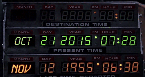
Getting Back to The Future at the End of 2025!
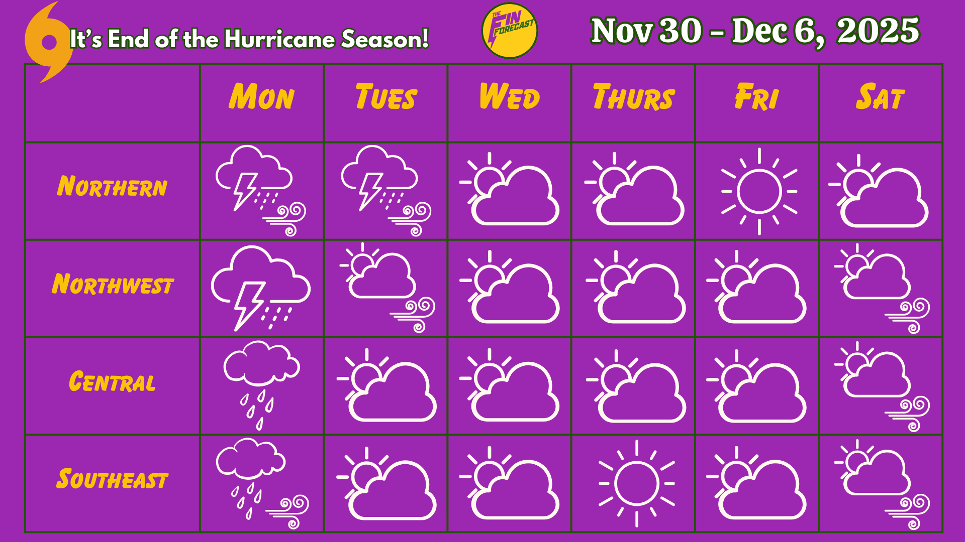
This week's forecast for The Bahamas for November 30 - December 6.

This newsletter is brought to you by Marjahn Finlayson.
40 years of Back to The Future!

Birthday Shoutouts
Happy Birthday to David Maynard and Cheiwah Ferguson!

Do you want a birthday shoutout? Click here to fill out a quick form.
Special Sky Report!
The full cold moon will occur on Thursday at 6:15 p.m. This will be a SUPER moon (close to Earth)! This week, the sun will set around 5:19 p.m. and rise between 6:37 and 6:41 a.m. Jupiter, Saturn and Uranus will be visible in the sky, while Mars, Neptune and Venus will be difficult to see. Mercury will become easier to see later in the week.
See what the astronomer are saying here. See what’s visible in the Bahamas here.
The Geminids Meteor Shower will occur between December 13 and December 14.
Recall that the spring tide, when the tide is the highest or the lowest of the month, occurs twice a month during full and new moons. See the Bahamian tide chart here.
The full moon will ask us to express our feelings when it comes to communication and adventure. Sagittarius season is all about more fun and seeing the big picture! Mercury is no longer in retrograde but still in Scorpio, so we do have intense feelings and deep-seated thoughts coming to the surface. Venus will move from Scorpio to Sagittarius today, so we go from intense feelings to fun and excitement in our relationships as well as flirting with adventure and becoming more open to new ideas. Mars in Sagittarius encourages us to go for it!
What do the astrology people say about ALL this?
Let's get into this week's forecast!
Current Conditions:
The radar shows activity near and over The Bahamas, and satellite shows clouds over the southeast Bahamas with some clouds near the rest of the country.
Tonight
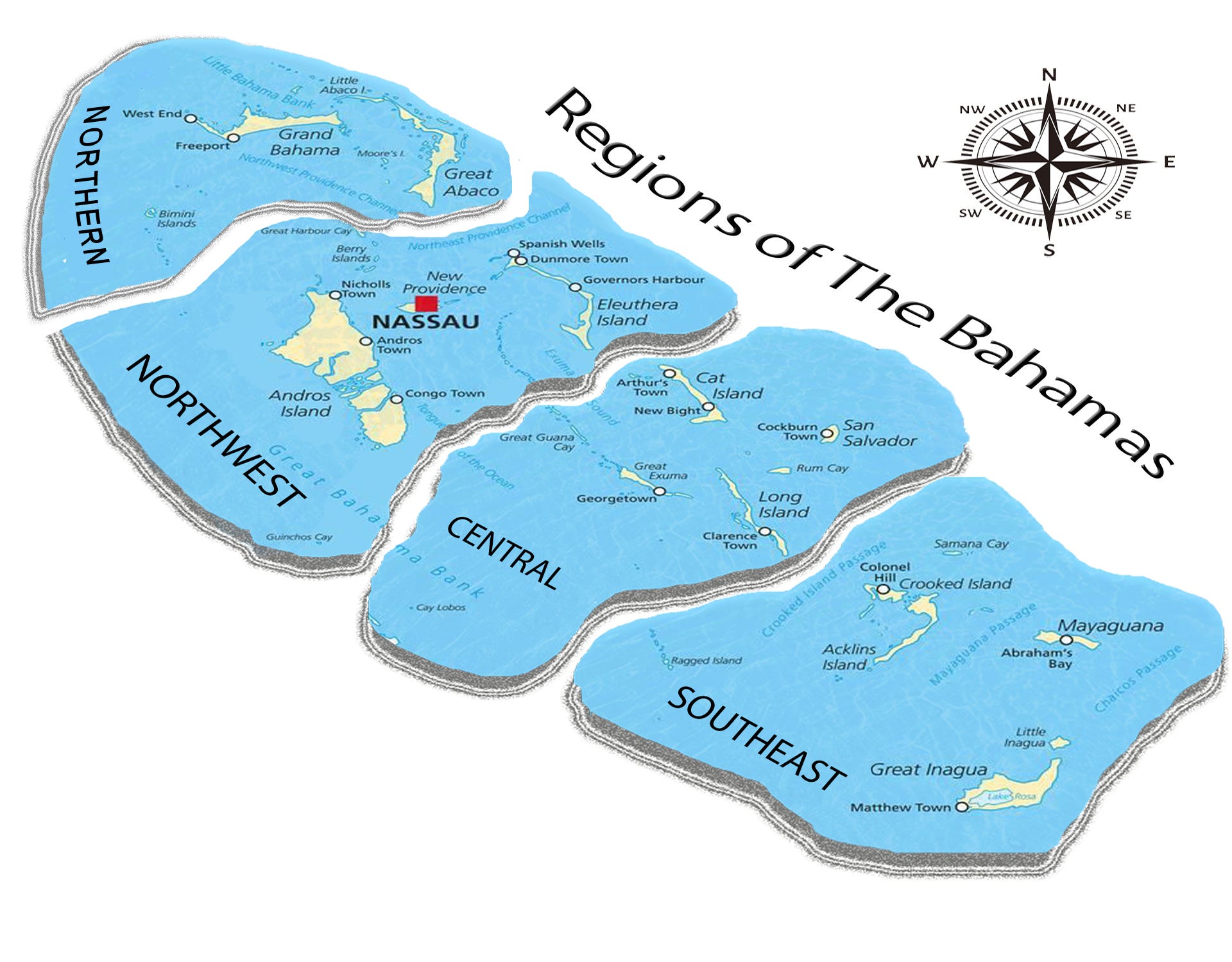
Expect rainy conditions everywhere, especially in the southeast. Thunderstorms may occur in the northwest and central region, but will likely occur in the southeast. Easterly winds will be calm (10 - 15 kts) and breezy (15 - 20 kts) in the northern and southeast regions and will be calm in the northwest and central regions. Temperature lows will be near 72 - 75°F in the northern region, 71 - 72°F in the northwest, 75°F in the central region and 76 - 77°F in the southeast. Expect sea swells on the Atlantic side of The Bahamas, especially in the southeast.
The Week Ahead:
Quick Summary:
Welcome to the end of the 2025 Hurricane Season! There is some frontal activity with week along with drops in temperature! To get an idea of how cool it may feel, add the heat index number to the high and low temperatures in these forecasts. Please watch out for Heat Advisories from the Bahamas Department of Meteorology!
Rain accumulation may range between 0.05 - 0.75 inches by next Sunday in the northern region. In the northwest, they may range between 0.05 - 0.50 inches. In the central region, they may range between 0.10 - 0.40 inches and 0.15 - 1.50 inches in the southeast. Flooding may occur in low-lying areas! This is also a reminder that you can see total rain accumulation here for multiple islands, thanks to the CoCoRAHS network!
The Blog:
On Monday, expect rainy conditions with clouds everywhere. Rainfall will be moderate in the northern, northwest and central regions and moderate to heavy in the southeast. Thunderstorms are likely to occur in the northern and northwest regions. Northeasterly and easterly winds will be calm and breezy in the northern and southeast regions and calm in the northwest and central regions with possible gusts. Temperatures will range with highs near 79 - 81°F and lows near 74 - 75°F in the northern region (Heat index +4°F to +5°F), highs near 81 - 83°F and lows near 70 - 73°F in the northwest (Heat index +5°F to +6°F), highs near 81°F and lows near 75 - 76°F in the central region (Heat index +4°F to +5°F), and highs between 83 - 84°F and lows near 76 - 77°F in the southeast (Heat index +5°F to +7°F). Expect sea swells on the Atlantic side of The Bahamas, especially around the southeast Bahamas.
On Tuesday, expect cloudy conditions with light to moderate showers everywhere with an increase in pressure. (There may be possible rainy conditions in the northern region at night). Thunderstorms are likely to occur in the northern region. Calm and breezy winds will start as southeasterly and southerly and become southerly and southwesterly later in the day in the northern region. Calm and breezy southeasterly and southerly winds will become light (5 - 10 kts) and calm southerly and southwesterly winds in the northwest. Southeasterly and easterly winds will be light and calm with gusts in the central region. Northeasterly and easterly winds will be light and calm with gusts in the southeast. Temperatures will range with highs near 80 - 81°F and lows near 73 - 74°F in the northern region (Heat index +4°F to +6°F), highs near 82 - 86°F and lows near 68 - 72°F in the northwest (Heat index +5°F to +6°F), highs near 82°F and lows near 74°F in the central region (Heat index +5°F to +6°F), and highs between 83 - 85°F and lows near 76 - 77°F in the southeast (Heat index +5°F to +6°F). There may be some sea swells around the northern and southeast Bahamas.
On Wednesday, there will be cloudy conditions with light to moderate showers, especially in the northern region. Thunderstorms are unlikely. A cold front may impact winds. Calm southwesterly and westerly winds will become light northerly and northeasterly winds in the northern region. Weak (0 - 5 kts) and light southwesterly winds will become light mostly northerly winds in the northwest. Weak and light winds will be mostly easterly and then become northeasterly in the central region. Northeasterly winds will be light and calm in the southeast. Temperatures will range with highs near 79 - 80°F and lows near 70 - 74°F in the northern region (Heat index +4°F), highs near 81 - 84°F and lows near 67 - 72°F in the northwest (Heat index +5°F), highs near 81°F and lows near 74 - 75°F in the central region (Heat index +4°F to +5°F), and highs between 82 - 84°F and lows near 76 - 77°F in the southeast (Heat index +5°F to +7°F). Expect sea swells in the southeast regions.

On Thursday, expect cloudy conditions with light showers, especially in the northern and southeast regions. Thunderstorms are unlikely. Northerly and northeasterly winds will be weak and light with gusts in the northern region. Northeasterly winds will be weak and light with gusts in the northwest and central regions, and calm with gusts in the southeast. Temperatures will range with highs near 78°F and lows near 70 - 73°F in the northern region (Heat index +3°F to +4°F), highs near 81 - 83°F and lows near 68 - 71°F in the northwest (Heat index +4°F to +5°F), highs near 80 - 81°F and lows near 74 - 75°F in the central region (Heat index +4°F to +5°F), and highs between 82 - 84°F and lows near 76 - 77°F in the southeast (Heat index +6°F to +7°F).
On Friday, expect partially cloudy conditions with light showers everywhere, especially in the southeast regions. Calm northeasterly and easterly winds will become easterly and southerly winds in the northern and northwest regions. Northeasterly and easterly winds will be calm with gusts in the central region. Northeasterly winds will be calm and possibly breezy in the southeast. Temperatures will range with highs near 78 - 79°F and lows near 73 - 74°F in the northern region (Heat index +3°F to +4°F), highs near 80 - 82°F and lows near 67 - 72°F in the northwest (Heat index +3°F to +4°F), highs near 80 - 81°F and lows near 74 - 75°F in the central region (Heat index +4°F to +5°F), and highs between 82 - 84°F and lows near 77°F in the southeast (Heat index +6°F to +7°F). Watch out for sea swells on the Atlantic side of The Bahamas.
On Saturday, expect partially cloudy conditions with light showers everywhere. Southeasterly and southerly winds will be calm and light in the northern region and will go from calm and breezy to light and calm in the northwest. Southeasterly and easterly winds will go from calm and breezy to light and calm in the central region. Easterly winds will be calm and breezy in the southeast. Temperatures will range with highs near 80°F and lows near 72 - 74°F in the northern region (Heat index +4°F to +5°F), highs near 81 - 84°F and lows near 69 - 73°F in the northwest (Heat index +4°F to +5°F), highs near 81 - 82°F and lows near 75°F in the central region (Heat index +5°F to +6°F), and highs between 83 - 84°F and lows near 77 - 78°F in the southeast (Heat index +7°F to +8°F). Watch out for sea swells around the entire country, especially in the central and southeast regions.

Hurricane News
The Atlantic Hurricane Season for 2025 is over today! Also, no tropical cyclone formation is expected in the next 7 days. We are still in an La Niña season until late winter.

The FIN FORECAST HURRICANE PREDICTIONS ARE OUT FOR $1.99!
ANNOUNCEMENTS & RESOURCES
These forecasts are subject to change throughout the week.
Check out our new website: www.finforecastweather.com!
Follow our social media on Facebook, LinkedIn and Instagram!
Also, keep up with Mr Weatherman on YouTube for more of a day-by-day report!
LET US KNOW HOW WE ARE DOING! HOW WAS LAST WEEK'S FORECAST?!
Follow the Bahamas Department of Meteorology on Facebook to keep up with the weather and to follow thunderstorm warnings and watches.
Remember to have your hurricane plan ready! For more information on this, check out the Masters of Disasters' article on how to prepare a hurricane kit! They also have tips on how to survive the heat and how to prepare for a flood! The Colorado State University updated hurricane forecast can be found here. You can keep up with tropical cyclone formation updates here.